History:
In the early eighteenth century, an expedition of Spanish missionaries and soldiers settled in the fertile lands bordering the San Antonio River. There they established the garrison of San Fernando de Bexar and the mission of San Antonio de Valero in the late spring of 1718. Later, in the winter of 1720, Father Antonio Margil de Jesus founded Mission San José y San Miguel de Aguayo. Missions Concepción, San Juan Capistrano, and San Francisco de la Espada were moved from East Texas and reestablished to serve the Coahuiltecan Indians by 1731. The missions of San Antonio became jewels in the crown of imperial Spain, for they were prosperous and successfully accomplished their purposes in the colonies.
Generally, a mission was a self-sufficient complex that included a protected compound with living quarters for its inhabitants (the soldiers, indigenous people and missionaries), workshops, a church, granary, mill and cemetery. Each mission had its own farm fields and extensive ranch lands that produced, not merely sufficient amounts of food for the populace, but a surplus that was distributed to less successful missions, or sold.
Water drawn from the San Antonio River irrigated the mission fields. This irrigation was accomplished through the acequias, an extensive system of canals that in some areas continues to serve the community.
About this Image:
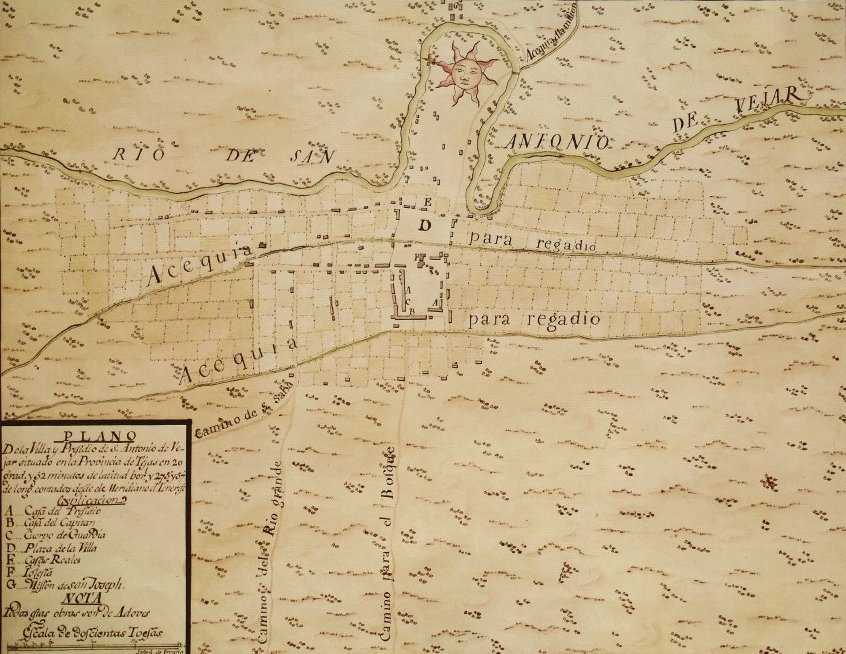
1) Plano de la Villa y Presidio de San Antonio de Vejar situando en la Provincia de Tejas from a manuscript by Joseph de Urrutia. This map shows the location of the Plaza de la Villa (D), or Main Plaza, with the Casa Reales (Spanish Courthouse) (E) and San Fernando Cathedral (F). To the west (below) lies Military Plaza, where the military quarters (A, B, C) are located. Above the horseshoe bend in the river, Mission San Antonio de Valero (G) has been misidentified as "Mission San Joseph." Original map held in the British Museum Library.
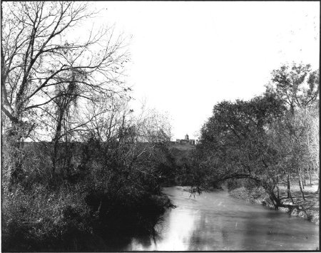
2) Looking south down the San Antonio River towards Mission San José, seen in the background.
3) Copy of a share certificate for the San Juan Ditch Water Supply Co., dated April 8, 1967. The San Antonio Conservation Society owned twenty shares in this company, which maintained the San Juan acequia and dam. The Society depended on the water from the acequia to nourish nearly 500 pecan trees growing on a piece of original mission farmland that it had purchased.
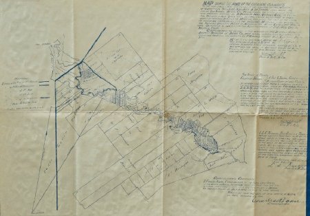
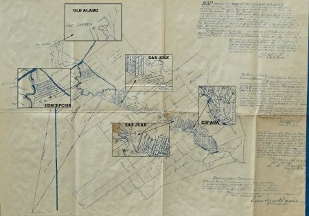
4–5) "Map showing the original claimants to the irrigable lands comprised in the labores (farm lands) of the Missions of Concepción, San José, San Juan, and Espada, lying below the city of San Antonio, Bexar County, Texas . . . Made by order of the Supreme Executive Power of Mexico, by the Most Excellent Provincial Deputation in 1824, under the administration of Political Chief Jose Antonio Saucedo . . ."
2) Looking south down the San Antonio River towards Mission San José, seen in the background.
3) Copy of a share certificate for the San Juan Ditch Water Supply Co., dated April 8, 1967. The San Antonio Conservation Society owned twenty shares in this company, which maintained the San Juan acequia and dam. The Society depended on the water from the acequia to nourish nearly 500 pecan trees growing on a piece of original mission farmland that it had purchased.
4–5) "Map showing the original claimants to the irrigable lands comprised in the labores (farm lands) of the Missions of Concepción, San José, San Juan, and Espada, lying below the city of San Antonio, Bexar County, Texas . . . Made by order of the Supreme Executive Power of Mexico, by the Most Excellent Provincial Deputation in 1824, under the administration of Political Chief Jose Antonio Saucedo . . ."
To Learn More:
Credit:
Courtesy of the San Antonio Conservation Society Foundation.
Click to Enlarge
 c. 1767
 2) N.d.
 3) 1967
 4) c. 1874
 5) c. 1874, map detailing the location of each mission
 c. 1767
 2) N.d.
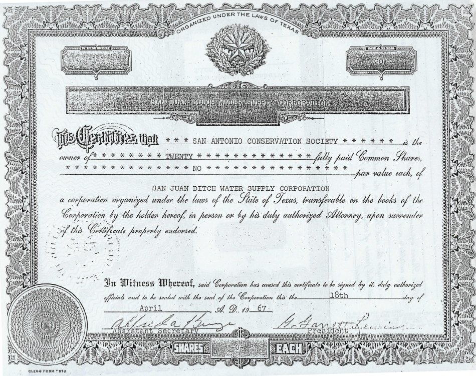 3) 1967
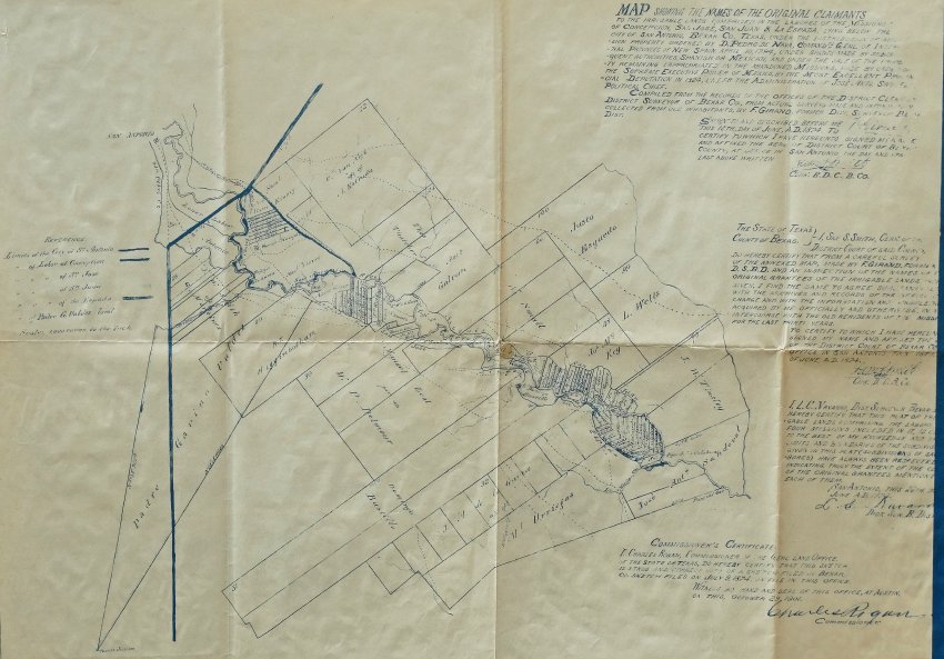 4) c. 1874
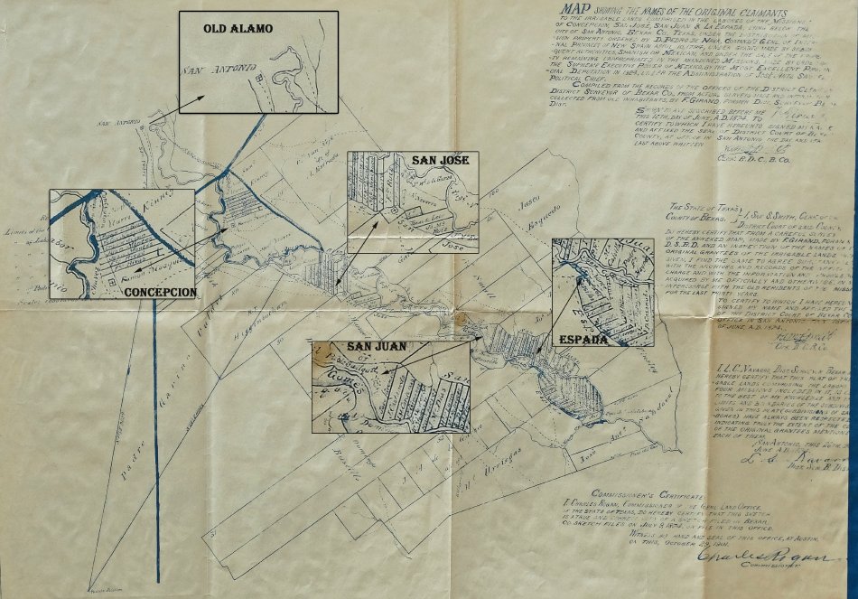 5) c. 1874, map detailing the location of each mission