
Saying Goodbye to Germantown
History:
Many Germantown residents felt devastated by the city's 1963 decision to construct an international fairgrounds and civic center on the very spot where they had lived, shopped, and worshipped - some for generations. In Urban Renewal Area 5, originally a 1,130-acre segment of downtown, the 92.6 acre HemisFair site encompassed the area bounded by S. Alamo on the West, Commerce Street on the North, the right of way for the new expressway (IH-37) on the East, and the soon-to-be extended Durango Boulevard (now Cesar E. Chavez) on the South.
The following narratives were written by volunteer Lee Grant, who reflects on some neighborhood experiences and memories. Click on the title to see a typed transcript of his recollections.
Peach Street
Groos House
About this Image:
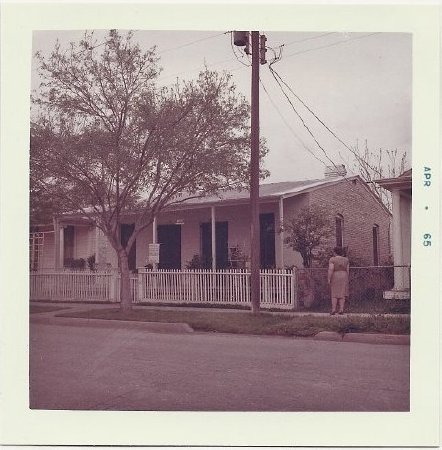
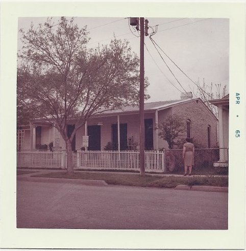
1) The Germantown neighborhood was described as "a quiet [residential] pocket in the downtown." Here, a woman stands on the sidewalk outside a well-tended house at 123 Wyoming Street in April of 1965.
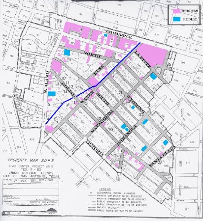
2) This map of the HemisFair area is color-coded to show the location of the acequia(blue line), plus commercial (pink) and public (light blue) properties that occupied the neighborhood prior to the fair. Adapted by Elizabeth Pople, original map from the City of San Antonio.
2) This map of the HemisFair area is color-coded to show the location of the acequia(blue line), plus commercial (pink) and public (light blue) properties that occupied the neighborhood prior to the fair. Adapted by Elizabeth Pople, original map from the City of San Antonio.
Credit:
Courtesy of San Antonio Conservation Society Foundation
Click to Enlarge
 1965
1965
 2) Map of Hemisfair Neighborhood
 1965
1965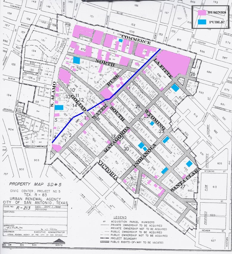 2) Map of Hemisfair Neighborhood